BeLaVi Westallgäu – some archaeological core results
A new archaeological landscape in Western Allgäu
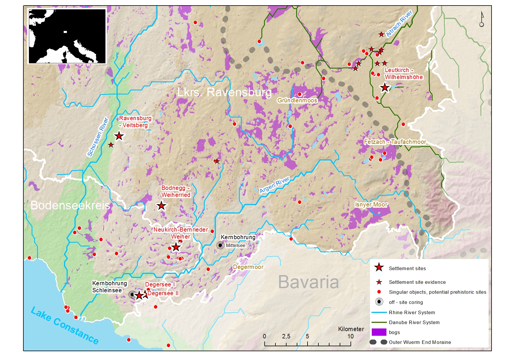
After completion of the BeLaVi project our maps of the working area are now populated with 114 prehistoric sites. About 45% of them date to the Neolithic, indicating - strongly supported by on-site and off-site palynological evidence - that the Westallgäu landscape was intensely used by Neolithic farming communities from the 5th millennium on. This means that the former empty space in the Neolithic map now fills a large portion of the gap between the Lake Constance / Upper Swabia areas and the Neolithic of the Bavarian Upper Danube region. The Neolithic map of Southwest Germany expands now to the foot of the Bavarian Alps. At the same time it becomes evident that the pre-alpine forelands of South Germany were much earlier used by farmers as hitherto thought.
Boom in the 38th century
There are differences and coincidences in relation to the neighboring landscapes. One important observation is that the bulk of the newly discovered sites, again supported by a multitude of natural scientific data, dates to the same period we already know from Lake Constance (“Middle Pfyn”) and Upper Swabia (”Pfyn-Altheim”) archaeological cultures.
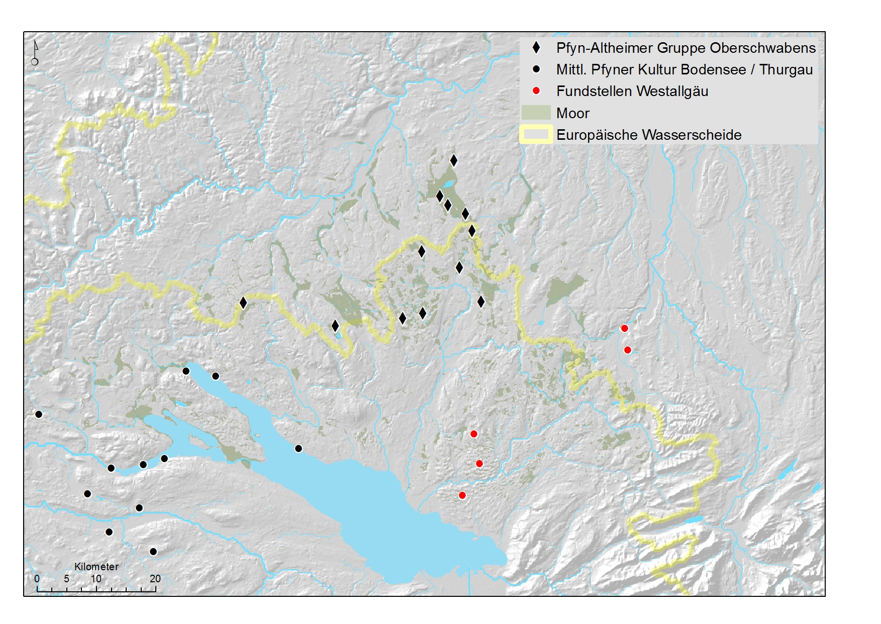
From the middle of the 38th century BC on farming communities expanded to hinterland areas in the backspace of the large pre-alpine lakes, settling at small lakes and bogs. In coincidence to the Upper Swabia evidence this phenomenon seems to last not much more than one century, rising questions on demographic and on paleo-climatic backgrounds.
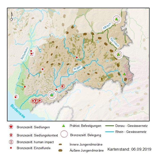
Hilltop sites
We need to keep in mind that due to methodological restrictions it is clear that we have only assessed a fraction of the archaeological remains that are still conserved. With the project focusing on the Neolithic periods and on waterlogged evidence investigations on mineral soils remained exceptional. However, it became evident that there is a considerate archaeological potential especially on hilltops and promontories and also at the colluvial moraine-flanks. Our observations consolidate the assumption that at least some of the many earthen wall – ditch fortifications known in the working area are of prehistoric origin. In some cases it can be shown that they are associated with Bronze Age materials.
An aquatic cultural landscape
Most of the newly detected sites have a close relation to lakes, bogs and water courses – which is not surprising in a physical landscape that has been formed by ice and water. Historical data from the Westallgäu and Upper Swabia regions illustrate the eminent role wet environments played as a resource for everyday life – providing with nutrition, fodder, house-construction materials, remedies, and even objects of spiritual life. Especially in cultural layers mainly consisting of natural components – as peat or limnic sediments - the safe identification of such materials as deposed and used by humans remains to be very exceptional. In view of the historical evidence we should be aware that the foraging portion in subsistence economy is potentially underestimated.
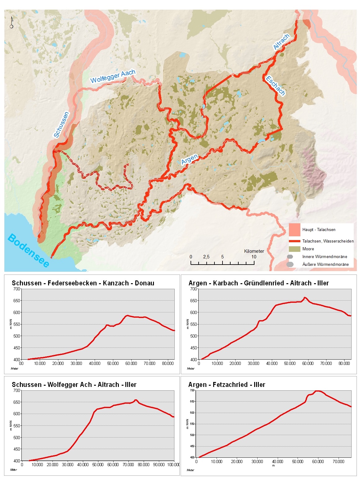
Another water-related aspect is highlighted by the two Neolithic hilltop sites within the working area – Ravensburg – Veitsburg (ca. 2900) BC and newly discovered Leutkirch – Wilhelmshöhe (ca. 4300 BC). Both are situated at bottleneck locations above the Schussen resp. Eschach River valleys. It must be assumed that in these cases contexts of goods exchange, mobility, and the close distance to or control of traffic routes was decisive for the choice of the settlement locations. Although a logboat found in Degersee lake illustrates that water bodies were navigated by watercraft, it remains open if river valleys were used travelling on paths along their flanks or navigating with small boats or floats. However, it seems to be quite plausible that many archaeological observations in in the Westallgäu , quite similar to Uper Swabia and the Federsee basin, have to be seen in the context of the European watershed that subdivides Rhenane and Danubian hydrological systems. From the archaeological point of view the watershed should be perceived as a land bridge and interface between the large cultural spaces in the North-East and the West. Models including distance and elevation illustrate that in such a perspective the Westallgäu can be understood as a small-river network and regional link between the dominating traffic axes across the Alps to the Upper Danube.
From a methodological point of view one of the most important outcomes of BeLaVI Westallgäu is the perception that archaeological means alone would have mislead to incomplete and potentially historically wrong deductions and results. Crucial roles played off-site palynological observations of laminated lake sediments again, but also on-site palynological observations. Linked to the archaeological data with AMS –radiocarbon dates, they provided with a reliable, independent data set and identified human activity at chronological and stratigraphic positions archaeology was not successful. In a sense, the archaeological toolbox proved to be a taphonomic filter. Future investigations and interpretation should keep that in mind.